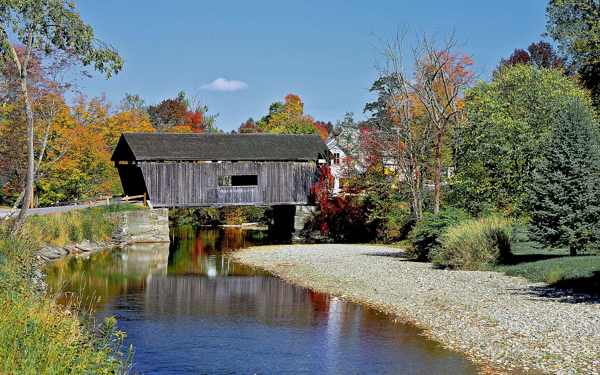
How We Picked
We evaluated each bridge on historic age, structural condition, accessibility by standard passenger car, scenic setting, and how naturally it fits into a broader day of driving. Vermont counts roughly 100 surviving covered bridges spread from Bennington County in the south to Franklin County in the far northwest. The picks here are ones you can reach on paved or well-graded roads without four-wheel drive, that are worth the stop on their own merits, and that chain logically into back-roads routes. Some still carry vehicle traffic; most are pedestrian-only now, a result of weight limits and changing road classifications. Start your trip planning at the Vermont Travel Guide to see how covered bridges fit into a broader Vermont itinerary.
Timing shapes the experience. The bridges photograph best from late September through mid-October, when the surrounding sugar maples turn orange and red. Summer brings wildflowers in the meadows below many spans, and the soft morning light of July works well for photographs. Mud season in April and early May can make some unpaved access roads soft or impassable, so check conditions before heading out to more remote bridges. Winter visits are possible but require caution on ice-prone back roads.
Gold Brook Covered Bridge (Emily's Bridge), Stowe
The Gold Brook Covered Bridge stands on Covered Bridge Road just north of Route 100 in Stowe, less than a mile from the main village. Built in 1844, it spans Gold Brook in a Townlattice truss design and runs approximately 50 feet end to end. Locals have called it Emily's Bridge since the 19th century, a nickname tied to a ghost story that has passed through several generations. The bridge itself is worth the stop regardless: a narrow wooden structure over a fast-running brook lined with old maples that hit peak color in the last week of September at this elevation.
Park on the shoulder near the bridge approach and walk through. The bridge is pedestrian-only. Green Mountain Inn, on Main Street in Stowe village, is well-positioned as an overnight base, about a mile south on Route 100. From Gold Brook in the morning you can add the 5.3-mile Stowe Recreation Path, the Trapp Family Lodge cross-country trails, or the Route 108 drive north through Smugglers Notch in the same afternoon.
Taftsville Covered Bridge, Woodstock Area
The Taftsville Covered Bridge crosses the Ottauquechee River in the hamlet of Taftsville, about 3 miles east of Woodstock center on Route 4. Built in 1836, it is one of the oldest covered bridges in Vermont that still allows vehicle traffic, which makes it genuinely unusual. The structure uses a multiple kingpost truss with Burr arch reinforcement and runs roughly 189 feet between abutments. It sits in a river valley below working farms, and the afternoon light on the bridge with the Ottauquechee below is one of the most-photographed scenes in the Upper Valley.
You can drive a standard vehicle through it (weight limits apply, and trucks are restricted). Woodstock Inn & Resort, on the village green about 10 minutes west on Route 4, is the natural base for a Woodstock-area covered bridge loop that also picks up the Middle Bridge and the Lincoln Bridge in North Thetford. Budget an hour for the Taftsville stop, including time for a short walk along the riverbank below the stone abutments.
Middle Covered Bridge, Woodstock
The Middle Covered Bridge connects Central Street and Elm Street over the Ottauquechee River right in the center of Woodstock village. The current structure dates from 1969, so it lacks the historic age of Taftsville, but the setting compensates: the bridge frames the village green and the surrounding white-clapboard architecture in a way that makes it the most-visited covered bridge in the Upper Valley. It is pedestrian-only, about 70 feet long, and worth walking slowly both directions.
Woodstock has two other covered bridges nearby (Taftsville and the Lincoln span a few miles out), so a half-day loop is easy to plan. After the bridges, the dining in and around Woodstock is strong year-round. For a broader view of the best eating options in this part of Vermont, the Best Farm-to-Table Restaurants in Vermont page covers several spots within a 30-minute drive. Billings Farm & Museum on River Road north of the village rounds out a full Woodstock morning.
Scott Covered Bridge, Townshend
The Scott Covered Bridge, located west of Townshend village on West Townshend Road in Windham County, holds a measurable distinction: it is the longest single-span covered bridge in Vermont at roughly 276 feet over the West River. Built in 1870 using a Lattice truss design, it is pedestrian-only today. Take Route 30 north from Brattleboro about 23 miles to Townshend, then turn west toward the bridge. The drive up Route 30 through the West River valley is itself one of the better back-road stretches in southern Vermont.
The West River runs wide and shallow below the span, and the combination of the long wooden tunnel and the open river valley behind it makes for one of the more dramatic bridge settings in the state. Chesterfield Inn, across the Connecticut River in West Chesterfield, New Hampshire, is about 35 minutes east on Route 9 and worth knowing for dinner or an overnight if you are running a southern Vermont covered bridge loop that also takes in Chiselville near Sunderland and the Bartonsville Bridge near Bellows Falls.
Chiselville Covered Bridge, Sunderland
The Chiselville Covered Bridge crosses the Roaring Branch of the Battenkill River in Sunderland, about 2 miles north of Arlington in Bennington County. Dating from around the early 1870s, it spans a steep rocky gorge cut by the Roaring Branch, and the view from the bridge deck down to the water and boulders below is the most dramatic of any covered bridge in Vermont. Take East Arlington Road north from Arlington center for about 1.5 miles; the bridge is well-signed from the road.
Manchester is the nearest base, about 6 miles north on Route 7A, with lodging options spread along Routes 7A and 11. This corner of southern Vermont also has Emerald Lake State Park a few miles away and easy access to the Battenkill River for trout fishing and swimming. For more on outdoor options in this same geography, the Best State Parks in Vermont page covers parks within an hour of this bridge.
The Six Bridges of Montgomery
Montgomery is a small town in Franklin County, about 25 miles northeast of St. Albans and 50 miles northeast of Burlington, in the upper Lamoille River watershed near the Quebec border. It has six covered bridges within a short drive of each other: the Hopkins Bridge (ca. 1875), Comstock Bridge (ca. 1883), Fuller Bridge (ca. 1894), Creamery Bridge (ca. 1883), Longley Bridge (ca. 1863), and Sanborn Bridge (ca. 1838). That concentration makes Montgomery the single best destination in the state for a focused covered bridge day. A self-guided loop on Montgomery Center Road and East Hill Road takes about 2 hours with stops at each bridge.
Some bridges are open to one-lane vehicle traffic; others are pedestrian-only. The surrounding hills turn in the last week of September, typically before the valleys below have fully shifted, so late September is the strongest window for this loop. Montgomery sits about 15 miles west of the Northeast Kingdom, and a longer two-day route can combine the Montgomery bridges with a drive east on Route 242 toward Jay Peak, then south through the Northeast Kingdom's lake and farm country around Island Pond.
Pulp Mill Covered Bridge, Middlebury
The Pulp Mill Covered Bridge spans Otter Creek on the east edge of Middlebury in Addison County, and historians place its construction somewhere around 1808 to 1820, which puts it among the oldest covered bridges in Vermont. It carries two lanes of vehicle traffic, a rarity among bridges of its age. The bridge is on Pulp Mill Bridge Road near the intersection with Creek Road, about a mile south of downtown Middlebury. The Otter Creek below it runs wide and calm here, lined with willows in summer.
Middlebury is a college town with a strong independent food scene and sits on Route 7 about 30 miles south of Burlington. If you are doing a multi-day covered bridge tour across central and western Vermont and need lodging along the route, the Vermont Inns and Hotels directory lists options in every region, including several in and around Middlebury and Vergennes. The drive from Pulp Mill Bridge north to the Montgomery bridges is about 1.5 hours via Route 116 through the Champlain Valley, a solid two-day circuit.
Bartonsville Covered Bridge, Rockingham
The Bartonsville Covered Bridge crosses the Williams River in Rockingham, near Bellows Falls in Windham County. The original bridge dated to the 1870s and used a Town lattice truss design; it was swept off its stone abutments in August 2011 by Tropical Storm Irene, which also destroyed or damaged several other Vermont bridges and road segments that season. The community raised funds, restored the abutments, and rebuilt the bridge using the original truss design. It reopened in 2012, making it one of the newest covered bridges in Vermont built to an old pattern. Take Route 103 north from Bellows Falls for about 2 miles, then follow signs to Covered Bridge Lane.
The rebuilt Bartonsville bridge is pedestrian-only and sits in a quiet river valley south of Bellows Falls. The Williams River here runs cold and clear, and the rebuilt structure is tighter and cleaner than many older spans, though the Town lattice design keeps it true to its original character. Bellows Falls, a small city on the Connecticut River about 12 miles north of Brattleboro and 2 miles off I-91, has a compact walkable downtown with independent shops and restaurants worth stopping at before or after the bridge.
Quick Comparison
| Bridge | Location | Est. Built | Approx. Length | Vehicle Traffic | Best Season |
|---|---|---|---|---|---|
| Gold Brook (Emily's Bridge) | Stowe | 1844 | ~50 ft | No | Late Sept–Oct |
| Taftsville | Woodstock area | 1836 | ~189 ft | Yes (car/light truck) | Year-round |
| Middle Bridge | Woodstock village | 1969 (rebuilt) | ~70 ft | No | Fall foliage |
| Scott Bridge | Townshend | 1870 | ~276 ft | No | Early Oct |
| Chiselville | Sunderland | ca. 1870 | ~60 ft | No | Any season |
| Montgomery (6 bridges) | Montgomery | 1838–1894 | Varies | Mixed | Late Sept |
| Pulp Mill Bridge | Middlebury | ca. 1820 | ~109 ft | Yes (2 lanes) | Year-round |
| Bartonsville | Rockingham | Rebuilt 2012 | ~150 ft | No | Fall foliage |
Frequently asked questions
How many covered bridges are in Vermont?
Vermont has roughly 100 covered bridges still standing, though the exact count shifts as bridges are damaged by floods or restored by communities. The state leads the country in covered bridge density by square mile. The highest concentrations are in the Upper Valley around Woodstock, in Franklin County where Montgomery alone has six bridges within a few miles of each other, and in Windham County in the south.
Which covered bridge is the longest in Vermont?
The Scott Covered Bridge in Townshend, Windham County, is the longest single-span covered bridge in Vermont at roughly 276 feet over the West River. It was built in 1870 and is pedestrian-only today. The Taftsville Covered Bridge near Woodstock, built in 1836, is one of the oldest in Vermont still open to vehicle traffic.
When is the best time to visit Vermont's covered bridges?
Late September through mid-October is the most popular window, when surrounding sugar maples are at peak color. The bridges look good in every season: summer light through the wooden lattice is distinctive, and winter visits are possible if roads are clear. Mud season in April and early May can make unpaved access roads difficult, so check conditions before heading to more remote bridges. Fall foliage in the Northeast Kingdom typically peaks a week or so before foliage in the southern part of the state.
Can you drive through Vermont's covered bridges?
Some, yes. The Taftsville Covered Bridge near Woodstock is one of the oldest in Vermont still open to standard car traffic, and the Pulp Mill Bridge in Middlebury carries two lanes. Most historic covered bridges in Vermont are now pedestrian-only due to weight limits and changing road classifications. Always obey posted signs and weight limits, and never attempt to drive through a bridge marked pedestrian-only.