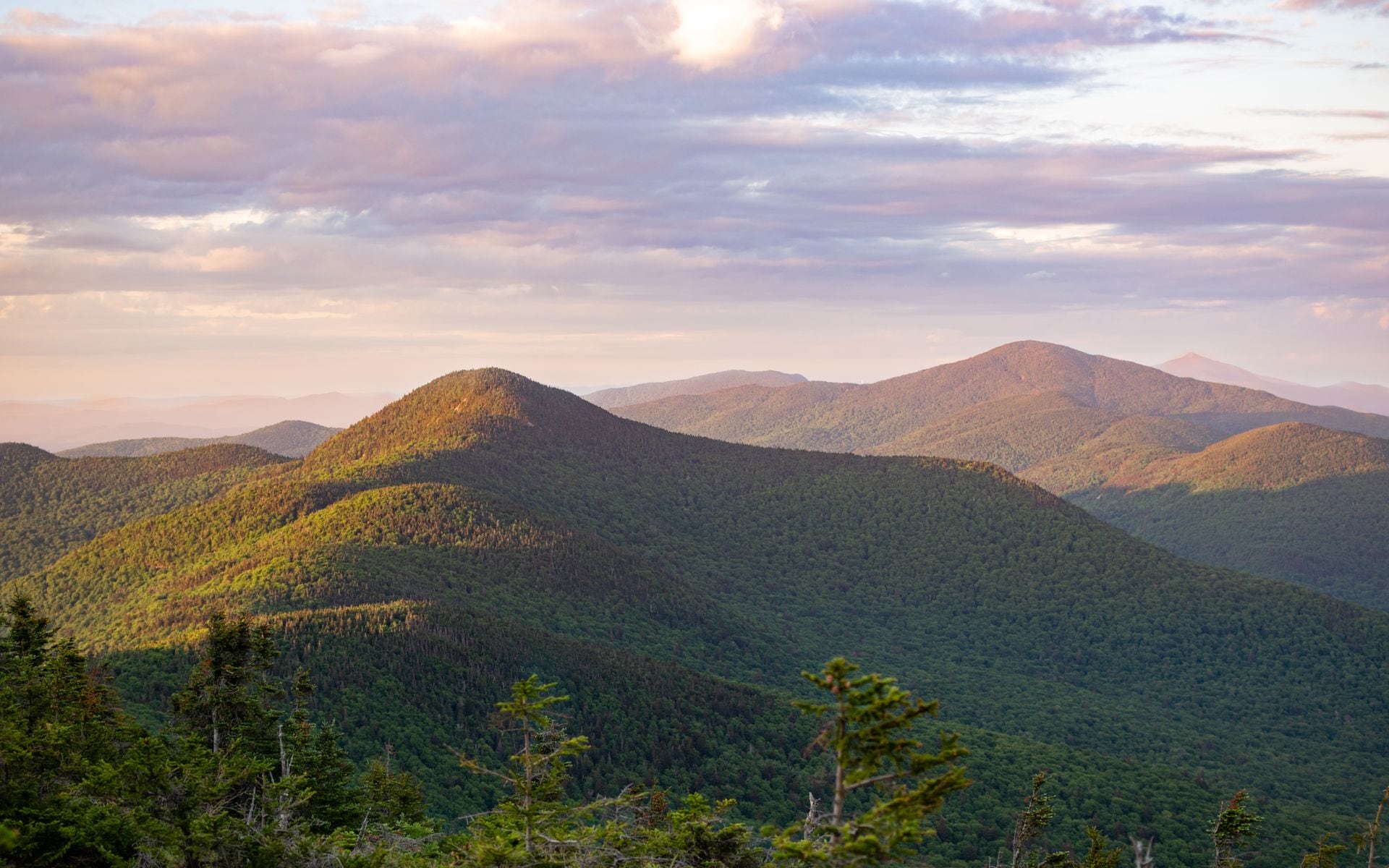
Overview
The Green Mountain Club built the Long Trail between 1910 and 1930, roughly two decades before the Appalachian Trail existed. The club's headquarters sit in Waterbury Center, just off Exit 10 on I-89, and the organization still maintains every mile of the Long Trail along with more than 175 miles of connecting side trails. From the Massachusetts border heading north, the Long Trail and the Appalachian Trail share the same footpath for about 105 miles before the AT diverges east toward New Hampshire near Sherburne Pass. That shared corridor puts two federally maintained trail systems on one ridgeline in the southern and central Green Mountains.
Outside the Long Trail corridor, the Green Mountain National Forest covers roughly 400,000 acres across the southern and central parts of the state, with trailheads accessible from Routes 4, 9, 100, and 108. Vermont's state park system adds terrain at every difficulty level, from Elmore State Park in Lamoille County to Camel's Hump State Forest outside Huntington and Mount Philo State Park in Charlotte on the Lake Champlain shore. Ski resorts including Killington Resort and Stratton Mountain Resort run summer hiking programs once the snow is gone, with gondola options and maintained summit trails. Burlington International Airport (BTV) is about 50 minutes by car from Stowe, which is the most practical northern base for Mount Mansfield and Smugglers' Notch trail approaches. For a full picture of where Vermont's hiking fits among its other outdoor options, the Vermont Travel Guide covers all six regions.
The Green Mountain Club sells a day-by-day Long Trail Guide covering every shelter, water source, and distance marker on the route, available at the Waterbury Center headquarters and at outdoor shops statewide. If you're planning more than a day hike, it's the single most useful piece of gear you'll carry.
What to Expect on the Trails
Vermont has four peaks over 4,000 feet, and each one requires real effort. Mount Mansfield at 4,395 feet is the highest point in the state, and the Sunset Ridge Trail from Underhill State Park is 6.6 miles round trip with about 2,300 feet of gain to the Chin, the true summit. Plan on four to five hours at a moderate pace. Camel's Hump at 4,083 feet is reached via the Monroe Trail from the Duxbury trailhead, a 7.4-mile round trip with 2,600 feet of elevation gain, typically four to six hours depending on conditions. Killington Peak at 4,229 feet is hikeable via the Bucklin Trail from Route 100 in Chittenden, a 7-mile round trip that bypasses the resort gondola entirely and starts from a free roadside trailhead. Mount Abraham at 4,006 feet rises above the town of Lincoln and sees considerably less foot traffic than Mansfield or Camel's Hump.
For shorter outings, Mount Philo State Park in Charlotte climbs about 500 feet in 1.5 miles each way to an open summit with views of Lake Champlain and the Adirondack Mountains in New York. It's accessible for most fitness levels and is a good option when you have two or three hours and a base in Burlington. Sterling Pond, reached from the top of Route 108 through Smugglers' Notch via a 2.8-mile round-trip spur off the Long Trail, sits at roughly 3,000 feet and takes about two hours. The cliffs of the notch are visible from the approach trail and the pond itself is quiet on weekday mornings.
The alpine zone on Mansfield and Camel's Hump deserves specific attention. The low, mat-forming plants on the summit rock are genuine arctic-alpine species that survive only because of the specific wind exposure and cold on these ridges. A single boot pressed onto them can set back decades of growth. Every trail sign above treeline on these mountains directs hikers to step only on rock or the marked trail surface, and Vermont hikers take that seriously. If you're new to alpine hiking, following the blazes closely above treeline is standard practice, not optional.
After a demanding day on the trails near Stowe, Soulmate Brewing Company in Morrisville, about 12 miles north of Stowe on Route 100, has built a real post-hike following for its IPA selection and down-to-earth taproom atmosphere. For hikers finishing near Burlington, the city's Breweries and Cideries scene is a short drive from most western trailheads.
Best Season for Hiking in Vermont
Late June through mid-October is the primary hiking window. September and the first two weeks of October are consistently the best weeks on the trails: conditions are dry, temperatures at elevation run in the 50s and 60s during the day, and the foliage on the ridge trails begins turning from the high country down. The summit views from Mansfield and Camel's Hump in late September can stretch to the White Mountains of New Hampshire and the Adirondacks of New York on a clear day. If you're pairing trail time with a drive, the best fall foliage drives in Vermont and the ridge trail views line up in the same window, late September through the first week of October. Even then, summit temperatures drop into the 40s at night and can be in the 50s during the day; layers are not optional.
Avoid trails above 2,500 feet from mid-April through Memorial Day. Vermont's mud season saturates mountain soil from snowmelt, and hiking on wet, soft trails causes erosion that lasts for years. The Green Mountain Club has posted this guidance at trailheads for decades and it stands. Late May is roughly when lower-elevation trails firm up, and by mid-June the high peaks are generally solid. June through August brings black flies in late May and early June, then mosquitoes through July, but at elevation a breeze handles most of it. Winter hiking is quiet and rewarding below treeline. The exposed ridges of Mansfield, Camel's Hump, and the Killington area ice over completely by December and require at minimum microspikes; crampons are more appropriate for the steep upper sections.
Typical Costs
Day hiking in Vermont is inexpensive. Most trailheads are free, including approaches to Camel's Hump, Mount Abraham, and Killington via the Bucklin Trail. State park day-use fees at parks with staffed entrances run an estimated $4 to $5 per adult at locations like Elmore State Park and Mount Philo. Long Trail backcountry campsites operate on a suggested donation of $5 per person per night, collected by Green Mountain Club caretakers at staffed shelters; lean-tos without a caretaker are donation-honor-system. The Green Mountain Club's annual individual membership is an estimated $45 per year, or $65 for a family, which includes a copy of the Long Trail Guide (retail estimate $22 to $25) and supports trail maintenance across the state.
Killington Resort's summer gondola to the upper mountain runs an estimated $30 to $45 per ticket when operating; the Bucklin Trail trailhead off Route 100 in Chittenden avoids the fee entirely. Stratton Mountain Resort's base-area nature trail is free and open without a lift ticket. For guided hiking days with a local outfitter, typical rates run an estimated $75 to $150 per person for a half-day trip depending on group size and terrain. Check the Breweries, Cideries and Tours directory for operators running multi-activity outdoor days in Vermont.
How to Plan and Book
Day hiking in Vermont requires no advance reservation. You drive to the trailhead and go. Most Long Trail overnight trips work the same way: lean-tos and tent platforms are first-come-first-served, and the $5 suggested donation is paid to caretakers on site. State park campgrounds that double as trailhead bases, including Elmore State Park on Lake Elmore in Lamoille County, should be reserved through the Vermont Department of Forests, Parks and Recreation website well ahead of September and early October when they fill quickly.
The von Trapp Family Lodge & Resort in Stowe sits on 2,400 acres of private land criss-crossed by hiking and Nordic trails. Lodge guests have full access to the trail network; non-guests can pay a day-use fee to access the Nordic trails in winter, estimated at $25 to $35 depending on season. The property's elevation and tree cover make it a reliable option for shoulder-season hiking when the high peaks are still icy. Killington Resort's summer gondola operates approximately late June through early October, weather and snowpack permitting; check the resort's schedule before planning around it.
For a well-routed week that combines Vermont's best trail time with valley stops, the Vermont Fall Foliage Road Trip itinerary pairs Camel's Hump and Stowe-area trails with the leaf season drives. After big trail days, the Farm-to-Table and Cheese Trails around the state give you a good contrast for a rest day, and local farms and creameries often sit within a few miles of major trailheads. Soulmate Brewing Company in Morrisville is a short drive north of Stowe on Route 100 and consistently earns a stop from hikers finishing the Mansfield area trails.
Frequently asked questions
Do you need a permit to hike the Long Trail in Vermont?
No permit is required for day hiking on any section of the Long Trail. Overnight stays at backcountry lean-tos and tent platforms have a suggested donation of $5 per person per night, collected by Green Mountain Club caretakers at staffed sites. There is no reservation system for Long Trail shelters; they are first-come-first-served. Weekends in September and early October are the most crowded; starting mid-week or planning a shelter backup option is a good idea during peak foliage weeks.
What is the best hike in Vermont for beginners?
Mount Philo State Park in Charlotte is one of the most accessible summit hikes in the state: about 1.5 miles each way, under 500 feet of elevation gain, and finishing with open views of Lake Champlain and the Adirondack Mountains in New York. Sterling Pond above Smugglers' Notch, reached from the Route 108 parking area, is another solid option at 2.8 miles round trip to a high-elevation pond at 3,000 feet. Both take two to three hours, are well-marked, and reward effort quickly without requiring technical footwear or long mileage.
When should you avoid hiking in Vermont?
Stay off trails above 2,500 feet from mid-April through Memorial Day. Spring snowmelt saturates mountain soil deeply, and hiking during mud season causes erosion that takes years to repair. The Green Mountain Club has posted this guidance consistently and it applies across all high-country trails in the state. Below 2,500 feet, lower-elevation paths firm up by late May. By mid-June, most trails on the high peaks are solid enough to travel without causing damage.
Can you hike Vermont's major peaks without a car?
Not easily. Most Vermont trailheads sit on rural roads with no transit service. Burlington has some accessible trails nearby, including the Ethan Allen Homestead area and paths along the waterfront, but the significant peaks, including Mount Mansfield, Camel's Hump, and Killington, all require driving. A rental car from Burlington International Airport (BTV) is the practical approach for most visitors targeting the state's major summits. The drive from BTV to the Camel's Hump trailhead in Duxbury takes about 45 minutes.