Why Visit the Upper Valley
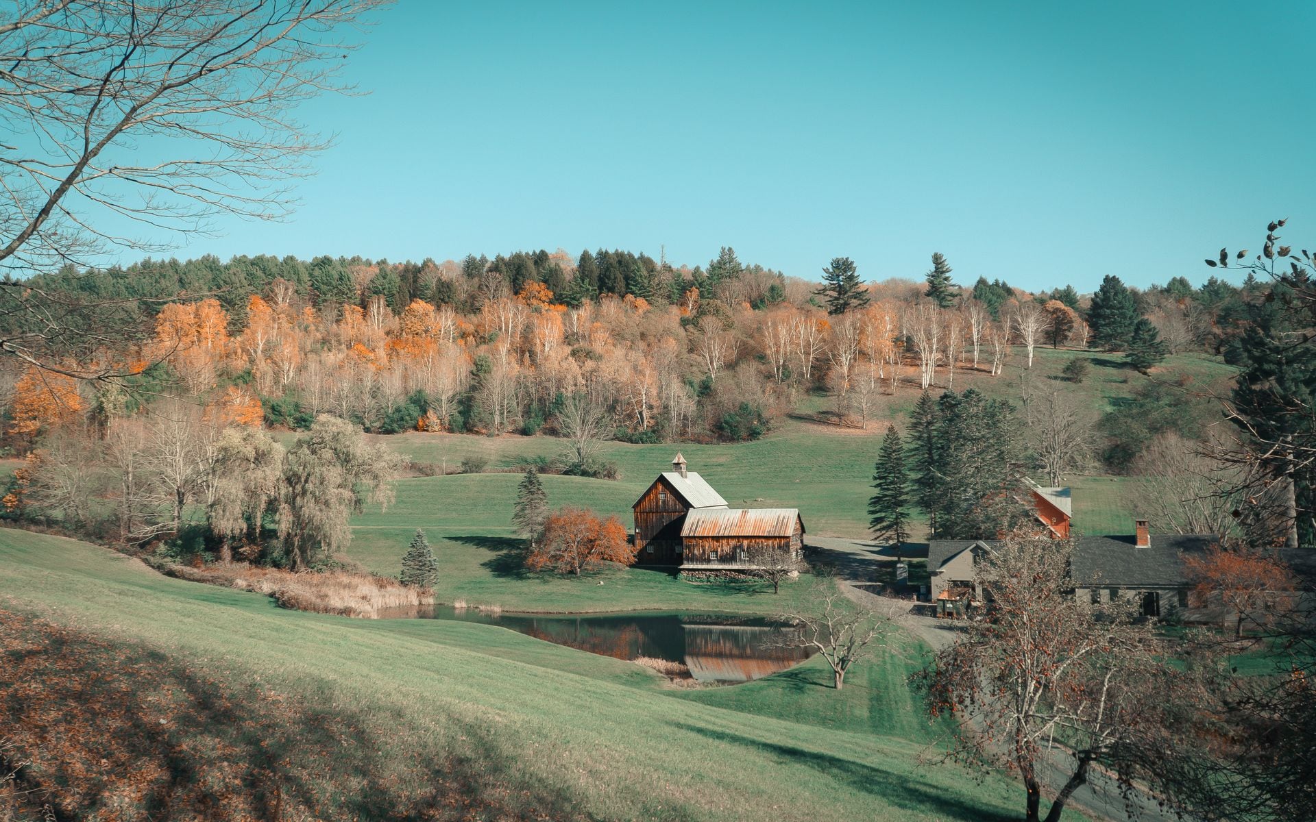
The Upper Valley runs along the Connecticut River Valley, a stretch of Vermont that developed early and shows it. Woodstock has a green ringed by Federal-style homes, three covered bridges you can walk between in twenty minutes, and a working dairy farm in plain sight of the village. The 19th century here doesn't feel like a museum exhibit: Billings Farm has had Jersey cows on the property since the 1870s, the covered bridges are still the fastest crossing over the Ottauquechee, and the Marsh-Billings-Rockefeller National Historical Park was a conservation model before most national parks existed. It's the kind of Vermont that doesn't try to tell you it's Vermont.
If you're reading the full Vermont Travel Guide, the Upper Valley offers a counterpoint to the ski-resort north and the lake-and-city energy of Burlington. Driving south on I-89 from Burlington takes about 1.5 hours and deposits you on Route 4, which follows the Ottauquechee east through Quechee and into Woodstock. If you're flying in, Lebanon Municipal Airport (LEB) in New Hampshire is 20 minutes east of Woodstock on Route 4 and has connector flights to major Northeast hubs. From Boston Logan (BOS), count on roughly 2.5 hours up I-91 and onto Route 4.
Top Places in the Upper Valley
Woodstock village is where most visitors spend the bulk of their time, and for good reason. The central green is lined by churches, a pharmacy, a library, and the historic Woodstock Inn, and three covered bridges sit within easy walking distance. The Middle Bridge spans the Ottauquechee directly behind the town hall, making it one of the only covered bridges in Vermont within a two-minute walk of a coffee shop. The Taftsville Covered Bridge, about 3 miles east on Route 4, is one of the oldest in the state and draws photographers year-round. Billings Farm and Museum, just north of the green on Route 12, runs daily programs on New England farm life, including maple sugaring in late February and a Harvest Festival each October. The adjacent Marsh-Billings-Rockefeller National Historical Park, the only national park in Vermont, offers 20 miles of maintained carriage roads and hiking trails through managed forest land, with a trailhead a five-minute walk from the village.
Five miles west on Route 4, Quechee Gorge drops 165 feet to the Ottauquechee River below. You can look into it for free from the Route 4 bridge in about two minutes, or take the trail down to the river floor, roughly 20 minutes each way on a well-worn path. The Vermont Institute of Natural Science (VINS) sits just east of the gorge with live raptor programs year-round featuring hawks, owls, and eagles; admission runs around $20 for adults and $12 for children (estimate). In Quechee village itself, Simon Pearce occupies a converted 19th-century woolen mill above the river. Glassblowers work in an open studio on the ground floor that you can watch for free, and the restaurant upstairs looks out over the falls and a covered bridge below.
North of Woodstock on Route 12, the valley opens into quiet farm country toward Barnard and Bethel. Silver Lake State Park in Barnard sits about 8 miles from the village and has a sandy beach, paddleboard rentals (estimate: $15-20 per hour), and a campground that fills by June for peak summer weekends. The drive up Route 12 itself passes several small covered bridges and dairy operations and is worth doing slowly with the windows down.
Top Things to Do
A covered bridge walk is the logical first morning in Woodstock. Walk the Middle Bridge from behind the town hall, pick up coffee at one of the shops on Central Street, and drive 3 miles east on Route 4 to see Taftsville. That circuit takes about two hours at an easy pace. From there, Billings Farm opens daily from early May through late October, with admission around $18 for adults and $9 for children (estimate). The farm's programming spans cheese making demonstrations, horse-drawn wagon rides, and period exhibits on 19th-century Vermont dairy farming. The Marsh-Billings-Rockefeller carriage roads branch off from the same entrance road and climb into old-growth forest with viewpoints looking south over the village and the Ottauquechee valley.
Quechee Gorge is a half-day stop. Walk the bridge overlook, hike down to the river, visit VINS for a raptor program, then drive into Quechee village to watch the glassblowers at Simon Pearce before or after a meal. State park day-use parking runs about $4-6 per vehicle (estimate). In summer, Silver Lake is the best swimming in the region, a small glacial lake in Barnard with clear water and a beach that's safe for kids. In winter, Suicide Six ski area operates a few miles north of Woodstock village with two chairlifts and terrain suited to beginners and families. Day passes run around $75-90 (estimate). The area is owned and operated by the Woodstock Inn, which gives it a connection to the village that most standalone ski areas don't have.
Where to Stay
The Woodstock Inn & Resort on the village green is the most complete base in the region, with rooms in the historic inn, a spa, a golf course, and multiple dining venues including the Red Rooster restaurant. Rates typically run $300-600 per night (estimate), higher during October foliage season. Book three to four months ahead for prime fall weekends. For a no-frills alternative, the Sleep Woodstock Motel sits on Route 4 on the west edge of town with clean rooms and convenient parking at around $100-160 per night (estimate). Several B&Bs and small inns operate in the village and in nearby Barnard, Pomfret, and South Woodstock. The Where to Stay in Vermont guide covers lodging options across all regions if you're still deciding where to base your trip.
Where to Eat
For a full dinner, Simon Pearce in Quechee is consistently regarded as one of the better restaurants in eastern Vermont. New England ingredients, river views, and glassware made on site add up to a meal that works for a celebration or a serious foliage-season dinner. Count on around $50-70 per person with wine (estimate), and reserve a table in October. Back in Woodstock village, Worthy Kitchen on Route 4 is a counter-service spot with locally sourced burgers and seasonal plates, lines on summer weekends, and prices around $14-20 per plate (estimate). It's about a mile from the village green and worth the walk on a warm evening.
Getting There and Around
Route 4 is the main corridor. From the west, take I-89 south from Burlington to Exit 1 in White River Junction, then Route 4 east through Quechee and into Woodstock, about 1.5 hours from Burlington. From the south, take I-91 north to Exit 9 in White River Junction, then Route 4 west. From Boston, I-93 north to I-89 north, exit at Lebanon NH (Exit 18), cross into Vermont on Route 4 and continue west about 20 minutes to Woodstock, roughly 2.5 hours total from Boston Logan (BOS). Lebanon Municipal Airport (LEB) is the closest commercial option, about 20 minutes east of Woodstock. Burlington International (BTV) and BOS are the realistic alternatives with more flight options.
There is no local bus service into Woodstock and no Amtrak stop. Woodstock village is fully walkable once you arrive, but getting to Quechee (5 miles west), Silver Lake (8 miles north), or the Taftsville bridge (3 miles east) requires a car. Plan on driving.
Best Time to Visit
Fall is the most-visited season in the Upper Valley by a significant margin. The Ottauquechee valley turns orange and red from late September into early October, and Woodstock's green becomes one of the most photographed spots in New England during peak color. Because the Upper Valley sits at lower elevation than the ski-town north, foliage arrives a week or two later than in the Northeast Kingdom or on the flanks of Mount Mansfield. A reliable target window is late September 28 through October 8, though current-year conditions vary. Our Best Fall Foliage Drives in Vermont covers the Route 12 north corridor, which is one of the more consistent drives in the state for color. Reserve lodging in September if you want the Woodstock Inn or nearby inns for a peak-foliage weekend.
Summer (late June through August) brings Billings Farm at full programming, swimming at Silver Lake, and hiking the Marsh-Billings-Rockefeller carriage roads. Winters are quiet outside the Suicide Six season, and the village itself is genuinely uncrowded. Late February into April is maple sugaring season, and a few sugarhouses near Barnard and South Woodstock open for tours and sales. Billings Farm runs sugaring demonstrations on weekends when the sap is running.
Frequently asked questions
How far is Woodstock Vermont from Burlington?
Woodstock is about 75 miles southeast of Burlington, which works out to roughly 1.5 hours by car on I-89 south to Exit 1 in White River Junction, then east on Route 4. The drive follows the Ottauquechee River through Quechee on the final stretch and is one of the more pleasant approaches in the state.
When does fall foliage peak in the Upper Valley?
The Upper Valley typically peaks between late September and mid-October, usually a few days to a week later than higher elevations in the northern Green Mountains. A good target window is September 28 through October 8, though you should check a current foliage tracker in the week before your trip. See our Best Fall Foliage Drives in Vermont page for recommended routes through the Ottauquechee valley and Route 12 north toward Barnard.
Is Quechee Gorge worth visiting?
Yes, and it takes as little as ten minutes if you just want the bridge overlook. The gorge drops 165 feet to the Ottauquechee River below, and the view from the Route 4 bridge is free. If you have more time, the trail to the river floor takes about 20 minutes each way. Pairing it with a visit to VINS next door and a stop at Simon Pearce in Quechee village makes for a full half-day out of Woodstock.
Do I need a car to get around the Upper Valley?
Yes. There is no local bus service in Woodstock and no Amtrak stop serving the village. Woodstock itself is walkable once you're there, but Quechee Gorge is 5 miles west, Silver Lake is 8 miles north on Route 12, and the Taftsville bridge is 3 miles east on Route 4. Plan to drive, and note that Lebanon Municipal Airport (LEB) is the closest airport at about 20 minutes away.