Overview
This itinerary runs north to south, starting at Burlington International Airport (BTV) and ending near White River Junction for an I-89 south or I-91 south departure. Total driving across seven days is roughly 250 miles, with no single transfer longer than 90 minutes. That leaves most mornings and afternoons free for hiking, eating, or stopping at whatever catches your attention along Route 100. The routing is designed so each base is within a short reach of the next, rather than backtracking across the state.
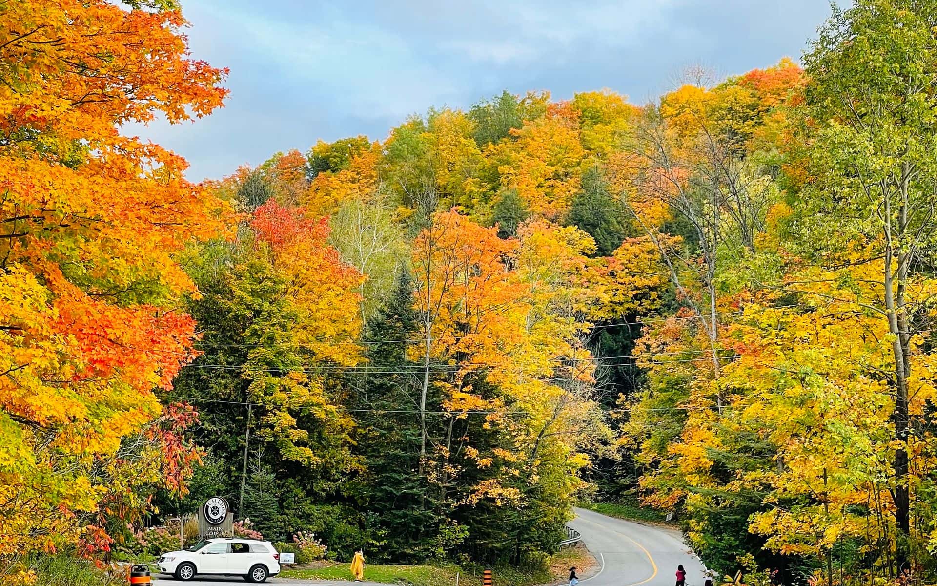
This route works in every season with some adjustments. In fall, the timing maps well onto foliage: the Northeast Kingdom sees color first, usually peaking in late September, while Burlington, Stowe, and Woodstock follow through mid-October. For a trip built entirely around the leaves, the Vermont Fall Foliage Road Trip gives specific route-by-route detail. For a winter trip centered on ski terrain, the Vermont Ski Week Itinerary restructures these same regions around the mountains. This general itinerary covers Vermont's year-round draw, with the mountain day on Day 4 easiest in summer and early fall.
Vermont runs on two-lane state highways, and GPS estimates run 15 to 20 percent short when Route 100 backs up on peak foliage weekends in late September and early October. Book lodging in Stowe and Woodstock at least three to four weeks ahead for those windows. The Vermont Travel Guide has planning pages for each region covered here.
Day 1: Arrive in Burlington
Most visitors fly into BTV or drive from Boston (about 3.5 hours on I-93 to I-89), New York City (roughly 5 hours via I-87 north to I-89), or Montreal (about 1.5 hours south on Route 15 to I-89). Burlington sits on the eastern shore of Lake Champlain, and arriving in the afternoon gives you time to get oriented before dinner. Church Street Marketplace is the pedestrian center of downtown, four blocks of local shops and restaurants between Main and Pearl streets. Walk the 8-mile waterfront bike path along the lake after that for the first real view of the Adirondacks across the water.
Dinner in Burlington covers a lot of ground. American Flatbread Burlington and Mothership Brewery on St. Paul Street does wood-fired pies in a communal, family-friendly room alongside house beers from the attached brewery. Farmhouse Tap and Grill on Bank Street takes a local-sourcing approach to burgers and seasonal plates, with a deep Vermont draft list and a basement bar that fills up on weekends. Either works for a first night in the city.
Day 2: Shelburne and the Lake Shore
Head south on Route 7 about 7 miles to Shelburne. Shelburne Museum sits on 45 acres with 39 historic buildings, a collection of folk art and Americana, and a full-size steamboat hauled overland from Lake Champlain in the 1950s. Admission runs roughly $27 for adults and $14 for children. A few miles west, Shelburne Farms is a 1,400-acre working farm on the lake built on a Gilded Age estate. The farm makes and sells its aged cheddar in the on-site shop, and the walking trails through the property reach the lake shore. If you time the return to Burlington for late afternoon, the light on the Adirondacks from the Route 7 corridor is worth slowing down for.
Burlington has enough of its own pull to fill a second evening. The Church Street area has independent bookstores, a farmers market on Saturdays from mid-May through October, and ECHO Lake Aquarium and Science Center on the waterfront, which is worth an hour if you want to understand the ecology of Lake Champlain before spending more time near it.
Day 3: The Waterbury Corridor and Stowe
Take I-89 north from Burlington and exit at Exit 10 for Waterbury, about 30 minutes. The Ben and Jerry's Factory is a half mile east of the interstate on Route 2 and runs tours most of the year for roughly $4 per adult. Even if you skip the paid tour, the Flavor Graveyard behind the factory building, which gives retired ice cream flavors actual headstones with epitaphs, is open and free. Prohibition Pig on South Main Street in downtown Waterbury is the lunch stop most regulars point to: smoked brisket, duck fat fries, and a rotating tap list that changes weekly.
From Waterbury, Route 100 north runs 20 minutes into Stowe village. The 5.3-mile paved Stowe Recreation Path follows the West Branch of the Little River from the village center toward the mountain, connecting several restaurants and breweries along Mountain Road. It is flat, car-free, and open year-round where snow allows. Piecasso on Mountain Road has wood-fired pizza and a full menu in a room that fills up fast on weekends, so arriving by 6:00 p.m. helps. Idletyme on Mountain Road pours house beers alongside burgers and a pub menu, and its patio fire pits stay lit through fall.
Day 4: Mount Mansfield and Smugglers' Notch
Route 108 north from Stowe climbs 10 miles up through Smugglers' Notch, a tight mountain pass where 1,000-foot cliff walls close in on both sides and car-sized boulders sit in the road margins. The pass is only open to passenger cars from roughly late May through mid-October, so this day works for summer and early fall visits. From the notch parking area, the Long Trail runs to the summit of Mount Mansfield, Vermont's highest point at 4,395 feet, in about 2 to 3 hours each way. The terrain on the upper ridge is exposed above treeline and can be slippery after rain. The Mount Mansfield Toll Road, which branches off Mountain Road below the notch, drives by car to around 3,800 feet and leaves a 45-minute ridge walk to the summit. The Toll Road costs roughly $30 per car and only takes cash, so plan accordingly.
In winter, skiing and snowboarding in Vermont centers on Stowe Mountain Resort on these same slopes, with more than 116 trails spread across the front and back of the mountain and a gondola that reaches the upper mountain. The gondola also runs for hikers and sightseers on summer and fall weekends, which gives the views without the full hike. Check the resort calendar before building Day 4 around the gondola in the off-season.
Day 5: The Northeast Kingdom
From Stowe, take Route 15 east through Morrisville and Johnson, then continue east on Route 15 to Route 2, and north on Route 2 to St. Johnsbury, about 70 miles and 90 minutes total. St. Johnsbury is the commercial hub of the Northeast Kingdom and holds two institutions that are easy to underestimate from the outside. The Fairbanks Museum and Planetarium on Main Street is a Victorian natural history collection with a working weather station and a planetarium under the original barrel-vaulted ceiling, admission under $10. Next door, the St. Johnsbury Athenaeum is a public library that opened in 1873 with an art gallery containing Albert Bierstadt's large panoramic painting of Domes of the Yosemite still in its original display alcove, admission under $7.
The Northeast Kingdom covers Essex, Caledonia, and Orleans counties, and foliage here typically turns a full week to ten days ahead of Burlington and Stowe, peaking in late September. If you have time after St. Johnsbury, Lake Willoughby in Westmore is 25 miles north on Route 5A, a glacial lake hemmed in by Mount Pisgah on the east and Mount Hor on the west. The lake road runs right at the base of those flanks and gives a different kind of Vermont scenery than anything else on this itinerary. Plan to overnight in or near St. Johnsbury to make the drive manageable.
Day 6: Montpelier and the Mad River Valley
Route 2 west from St. Johnsbury covers 38 miles to Montpelier in about 45 minutes. Montpelier is the smallest state capital in the country by population, and its downtown has no chain restaurants, which is genuinely useful information for planning. The State House is open for free self-guided tours on weekdays, with its gold dome visible from the Winooski River below. Hubbard Park behind the city is a 194-acre city forest with trails and a stone observation tower that overlooks the hills. Lunch downtown runs you into a mix of independent spots without a lot of pre-planning required.
From Montpelier, Route 2 west to Route 100B south puts you in the Mad River Valley and Waitsfield in about 25 minutes. The drive along Route 100 through the valley follows the Mad River past dairy farms and covered bridges, and it is one of the more straightforward pieces of Vermont two-lane highway. Sugarbush Resort sits above Warren at the south end of the valley. In summer the mountain bike park runs on the lifts; in winter it is one of Vermont's major ski areas. Waitsfield village has a handful of restaurants and overnight options if you want to break the next day's drive into Woodstock.
Day 7: Woodstock and Quechee Gorge
From Waitsfield, Route 100 south through Granville Gulf (a narrow forested gorge of its own, worth slowing down for) and Rochester reaches the Route 4 junction near Killington in about 45 miles. Turn east on Route 4 and drive another 17 miles to Woodstock village, arriving in roughly 65 minutes total from Waitsfield. Start with Woodstock itself: the village green, the covered bridge on Elm Street a few blocks from the center, and the Billings Farm and Museum on River Road about a mile from downtown. The farm is a working dairy operation open from May through October, and the museum side covers 19th-century Vermont farm life with hands-on exhibits. Marsh-Billings-Rockefeller National Historical Park is directly adjacent, with 20 miles of carriage roads and trails through old-growth forest.
Continue 6 miles east on Route 4 to Quechee Gorge, where the Route 4 bridge crosses the gorge at 165 feet above the Ottauquechee River. The roadside overlook is free, and a short trail descends to the gorge floor if you want a different angle on the rock walls. Simon Pearce in Quechee village, about a mile east of the gorge bridge, serves New England cuisine in a restored 1800s mill building with river views from the dining room; you can walk through the glassblowing studio before or after eating. From Quechee, I-89 south at White River Junction reaches Boston in about 2.5 hours and the New York metro area in about 4.5 hours via I-91 south.
Where to Stay
In Burlington, Hotel Vermont on Cherry Street sits half a block from the lakefront and runs a bar program focused on local spirits and Vermont-made products. In Stowe, the Green Mountain Inn on Main Street is an 1833 building updated with a pool, two restaurants, and room for families. It is walkable to the village shops and to the start of the Recreation Path. The Lodge at Spruce Peak at Stowe Mountain Resort is the ski-in, ski-out option for Days 3 and 4, closer to the gondola and mountain trails. For the Woodstock end of the trip, the Woodstock Inn and Resort faces the village green directly with a golf course, spa, and Red Rooster restaurant on the property.
If you want to keep lodging costs down on the Stowe nights, the Best Western Plus Waterbury-Stowe in Waterbury sits 20 minutes from Stowe village at a lower price point and includes breakfast. It works well on Day 3 if you want to base close to the Ben and Jerry's factory and drive up to Stowe for the day.
Book These Ahead
Lodging in Stowe and Woodstock books up three to four weeks out for late September and early October foliage weekends, and peak ski weekends in January and February run tight as well. The Ben and Jerry's Factory tour books online and morning slots fill quickly in July and August. The Mount Mansfield Toll Road accepts cash only at roughly $30 per car and has limited uphill capacity on clear summer weekends, so an early start (before 9:00 a.m.) avoids the wait. Shelburne Museum runs timed-entry tickets during peak season and the Saturday farmers market in Burlington does not require anything, but arriving by 9:00 a.m. gets you the best selection at the farm stands.
Frequently asked questions
Can I do this 7-day Vermont itinerary in reverse, starting in Woodstock?
You can reverse the route, starting in Woodstock and finishing in Burlington. The main trade-off is that Burlington (BTV) is a more practical departure airport than anything near Woodstock, so flying out of the state gets complicated. Driving-wise, the reverse direction works fine on the roads. One thing to keep in mind for fall visitors: the Northeast Kingdom sees foliage earlier than Woodstock and the Upper Valley, usually by about a week to ten days, so reversing the itinerary in late September means you may arrive in the Northeast Kingdom slightly past peak color.
Is 7 days enough to see Vermont?
Seven days covers the state's main regions at a reasonable pace. Vermont's towns sit 30 to 90 minutes apart on two-lane roads, so moving between Burlington, Stowe, the Northeast Kingdom, and Woodstock takes real driving time. If you have fewer days, a focused shorter itinerary works better than trying to compress this one. For a ski-focused winter week, the Vermont Ski Week Itinerary is built around the mountains rather than cross-state driving, which is the better framework for that kind of trip.
What is the best time of year for this 7-day Vermont itinerary?
Summer (June through August) gives you the fullest access: Route 108 through Smugglers' Notch is open, Mount Mansfield hikes are dry, Lake Champlain is swimmable, and Billings Farm runs its full season. Fall (late September through mid-October) adds the foliage dimension and is the most visually rewarding window, with the Northeast Kingdom peaking first. The Vermont Fall Foliage Road Trip adds detail on specific foliage drives if that is your main goal. Spring (March through May) is mud season, with back roads sometimes impassable and some attractions not yet open. Winter works if you replace the mountain hiking days with ski days and adjust expectations for Route 108 being closed.