The Short Answer
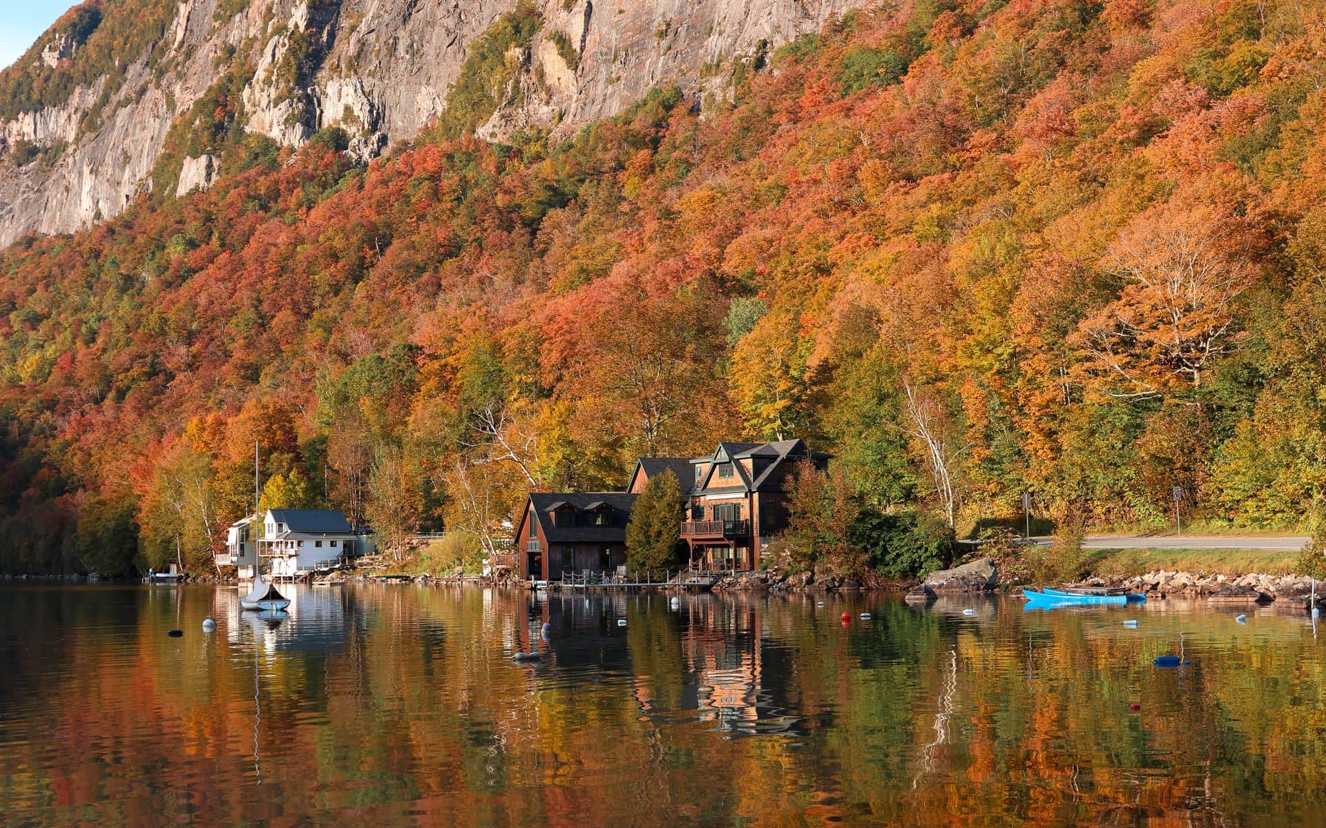
Vermont has four genuinely distinct seasons, each with real weather character. Winter runs from December through March, with January and February bringing the deepest snow at Stowe, Killington, Jay Peak, and Sugarbush. Spring, which Vermonters call mud season, runs roughly mid-March through early May, when freeze-thaw cycles turn unpaved roads soft and some smaller inns close for the off-season. Summer is warm and green, with Burlington averaging around 83°F in July and Lake Champlain comfortable for swimming by mid-July. Fall is the marquee window, with foliage rolling from high-elevation terrain and the Northeast Kingdom in mid-September down through southern Vermont by mid-October.
If you are still deciding which season fits your trip, the Best Time to Visit Vermont guide breaks down trade-offs by traveler type. This page goes month by month through what the weather does. One important context note: the temperature figures in the table below come from Burlington International Airport (BTV), which sits at 335 feet above sea level on Lake Champlain's eastern shore. Mountain elevations, including the ridges above Stowe, the peaks around Killington, and the high terrain in the Northeast Kingdom, run 10 to 20 degrees Fahrenheit colder on any given day and receive substantially more snowfall.
Vermont Weather Month by Month
| Month | Avg High °F | Avg Low °F | Typical Conditions | Visitor Notes |
|---|---|---|---|---|
| January | 28 | 10 | Cold; regular snowfall; mountain below-zero nights | Peak ski season; plan for real cold |
| February | 31 | 13 | Cold; deepest snowpack of the season | Best ski conditions; midweek rates lower |
| March | 42 | 25 | Thawing days, cold nights; mud season starts | Sugaring season; avoid dirt roads |
| April | 56 | 36 | Mud season; rainy stretches; roads posted | Lowest prices of the year; stick to paved routes |
| May | 68 | 46 | Warming fast; landscape greens up quickly | Waterfalls at peak flow; few visitors |
| June | 77 | 56 | Warm; green; afternoon showers possible | Hiking and cycling season opens; Route 108 through Smugglers Notch reopens |
| July | 83 | 61 | Warmest month; thunderstorms possible; mountains stay cool | Lake Champlain swimming; Long Trail hiking; farmers' markets weekly in Burlington and Montpelier |
| August | 81 | 59 | Warm; first hints of color on high ridges late in the month | Good hiking; quieter than fall; early foliage visible above 3,000 ft |
| September | 72 | 50 | Cool and crisp; foliage begins in north and at elevation | Northeast Kingdom peaks late September; book lodging ahead |
| October | 60 | 40 | Crisp; peak foliage statewide; frost likely | Busiest month; Columbus Day weekend is peak; prices highest |
| November | 46 | 30 | Cold; first significant snowfall in mountains | Ski resorts begin opening; shoulder pricing returns |
| December | 33 | 17 | Winter conditions; snowfall increasing through month | Ski season in full swing; holiday week busy and expensive |
All temperature data reflects Burlington averages near Lake Champlain at 335 feet elevation. Mountain summits, northern county terrain, and the high ridges above Stowe run 10 to 20°F colder year-round and receive far more precipitation as snow.
How Elevation Changes Vermont's Weather
The readings in the table above are accurate for the Burlington corridor but tell only part of the story. Burlington sits at 335 feet on the flat Lake Champlain shoreline, and the lake's thermal mass keeps the city slightly warmer in winter and measurably cooler on summer afternoons than inland Vermont towns at the same latitude. Head east into the Green Mountains and conditions shift fast. The Chin, the highest point on Mount Mansfield at 4,393 feet above sea level, averages temperatures roughly 20°F colder than the Burlington station on any given day. A July afternoon that feels warm in Stowe village at around 1,300 feet base elevation can feel like early October up on the ridge.
That elevation gradient drives Vermont's foliage timing more than any other factor. Sugar maples above 2,500 feet react to shortening daylight and cooling nights about 10 to 14 days before trees at valley floor elevations. The high terrain in Orleans County and the peaks above Stowe are often at near-peak color in the third week of September while the Winooski River valley and the Connecticut River corridor are still fully green. For exactly how to read that color calendar by region and elevation, our Leaf-Peeping Tips and Etiquette page goes into detail.
In winter, the same effect determines where Vermont's heaviest snow falls. Jay Peak in Orleans County sits at 3,968 feet summit elevation and averages around 355 inches of snowfall per season, the highest of any Vermont resort. Its northern position and the way its summit intercepts Nor'easters tracking up the Connecticut Valley both contribute to that total. Killington averages roughly 250 inches per season at its upper elevations across six peaks. Burlington, in the lake corridor, averages around 80 inches per year and rarely sustains a real snowpack at street level for more than a few days between storms.
Season by Season: What to Plan For
December through March is ski season, and mountain resort areas, including Stowe, Killington, Sugarbush in Warren, Jay Peak in Jay, and Smugglers' Notch Resort in Jeffersonville, see their highest visitor volumes from Friday through Sunday during those months. Road conditions on two-lane routes like Route 100 through the Mad River Valley or Route 108 north of Stowe can change quickly after a storm. Route 108 closes to vehicle traffic through Smugglers Notch in November and typically reopens in late spring once the snowpack clears. All-wheel drive or snow tires are practical rather than optional for mountain driving in January and February.
March and April are mud season. The freeze-thaw cycle that drives maple sap flows (sugaring runs from late February through early April in most years across Addison, Washington, and Lamoille counties) also saturates unpaved roads. Towns in Caledonia, Orange, and Washington counties post seasonal weight limits, and some rural roads close temporarily when the frost comes out. If your itinerary includes back roads in those areas, call ahead or check with your inn. The upside for tolerating this window is a noticeably quieter state and the lowest lodging prices of the year. Our Vermont Trip Cost and Budget guide covers the full seasonal price swings in detail.
June through August brings warm temperatures to the valleys and good conditions in the mountains. Lake Champlain surface temperatures reach the low to mid 70s°F by July, comfortable for swimming at beaches in Colchester, Burlington's waterfront, and on North Hero and Grand Isle in the Champlain Islands chain. The Long Trail, which covers 272 miles from the Massachusetts border north to the Canadian line, is most accessible from June through September, with higher sections usually clear of ice and heavy mud by late June in a typical year.
September and October are the foliage window, and Vermont's most traveled season. Burlington's average high of 72°F in September drops to 60°F in October, and nights turn cold enough to need a real jacket after dark. The Northeast Kingdom, the forested stretch of Orleans, Caledonia, and Essex counties near the Canadian border, peaks first, usually in the last week of September. The hills around Stowe and the Mad River Valley follow closely. Southern Vermont, including the area around Manchester and Brattleboro, can hold color into the third or fourth week of October. Foliage season is also when Vermont charges its highest lodging prices: expect $250 to $500 per night at inns in Stowe, Woodstock, and Grafton on peak weekends, with two-night minimums common.
Practical Tips for Planning Around Vermont's Weather
Pack for temperature swings regardless of the season. In October, a sunny afternoon in Middlebury at 65°F and a cloudy evening in Stowe after dark at 38°F are equally normal for the same day. In summer, a Burlington afternoon can reach 85°F while the summit of Mount Mansfield stays below 60°F. The rule for hiking above treeline in Vermont is straightforward: bring a layer, bring rain protection, and check the summit forecast rather than the valley forecast before heading out. Mountain weather in Vermont changes faster than most visitors expect, and the upper sections of the Long Trail become exposed and cold with very little transition from the sheltered lower slopes.
For driving, Vermont's two-lane state highways handle ordinary conditions well, but they ice quickly and take time to plow after a storm. Allow extra time on Route 100 through the Mad River Valley, Route 2 across the northern tier of the state, and Route 9 between Wilmington and Brattleboro if those routes are in your winter itinerary. The foliage-season equivalent of a storm warning is Columbus Day weekend in early October: Route 100 north of Killington sees heavy traffic, roadside parking backs up at well-known viewpoints, and Stowe village fills completely. A day earlier or a day later than Columbus Day weekend makes a real difference in both traffic and the ease of finding lodging. For a broader trip-planning picture that ties weather to timing and budget, the Vermont Travel Guide covers suggested itineraries, regions, and where to base yourself for each season.
Frequently asked questions
What is the coldest month in Vermont?
January is typically the coldest month, with Burlington averaging a high of 28°F and a low of 10°F. At mountain elevations around Stowe, Killington, and Jay Peak, temperatures regularly drop below zero Fahrenheit at night. January and February are peak ski season, so the cold is expected, and mountain resort towns are fully equipped for it with heated base lodges, gear rentals, and ski-in lodging.
When does it snow in Vermont?
Meaningful snowfall arrives in the mountains by mid-November most years and persists through March, sometimes into April at higher elevations. Burlington averages around 80 inches of snowfall per season, while Jay Peak in Orleans County averages around 355 inches and typically has the most reliable snow conditions in the state. Killington can see snowfall on its upper trails as late as May and often keeps some terrain open into April or early May, giving it the state's longest ski season.
How hot does Vermont get in summer?
Burlington's average July high is 83°F, making it warm but rarely extreme. Temperatures above 90°F occur but are not typical, and the Green Mountains stay noticeably cooler than the Lake Champlain corridor on most summer days. Lake Champlain surface temperatures reach the low to mid 70s°F by mid-July, comfortable for swimming. Summer is also the least-crowded season in Vermont relative to fall, so lodging is easier to find and prices are lower across the state.
What is mud season in Vermont and when does it happen?
Mud season is the period from roughly mid-March through early May when alternating freeze-and-thaw cycles saturate unpaved roads and make rural back roads difficult or impassable. Most of Vermont's smaller towns connect by at least some dirt roads, and many post seasonal weight limits to prevent road damage. Some smaller inns close for a few weeks during this period. If you plan to travel in April, stick to paved state routes and confirm your accommodation is open before booking travel.
When is the best weather in Vermont for outdoor activities?
Late June through August for hiking, cycling, and lake swimming. September and early October for foliage drives and lower-elevation hiking, with crisp temperatures and long, clear days. January and February for skiing, with the deepest snowpack of the season. The shoulder months of late May and late October offer manageable weather and low visitor volume, though May in the mountains can still be cold and wet at elevations above 2,500 feet.