Vermont has roughly 100 covered bridges still standing, more per square mile than any other state in the country. This guide breaks down where to find the best ones, which are worth the detour, and how to time your visit.
Why Vermont Still Has This Many Covered Bridges
Bridges were covered not for scenery but for function. The wooden planking in an uncovered bridge would rot within ten or fifteen years from rain and snow. Cover the bridge and protect those timbers from the weather, and you could get fifty years or more out of the same structure. Vermont, heavily forested and laced with rivers and streams that needed crossing, built several hundred of them through the 1800s. About 100 survive today.
Most of what remains dates from 1820 to 1890, built from local white pine and hemlock using timber-frame techniques. Lattice truss, Town lattice, and Burr arch are the most common designs you’ll see identified on the plaques. They’re concentrated in farming valleys where rivers cross frequently: Windsor County near Woodstock, Franklin County near Montgomery and Enosburg, Orange County, and scattered across Addison and Lamoille counties. If you’re building a route, the Vermont Travel Guide has regional breakdowns that help you cluster bridge stops alongside other places worth visiting in the same area.
Visiting the bridges is free. Almost all sit on public roads or have small pull-offs. The challenge is navigation: most are on numbered town roads or unpaved forest routes that don’t show up on highway signs. Download a Vermont Covered Bridge map from the Vermont Division for Historic Preservation before you go, or use the state’s online covered bridge database as your reference. A GPS that routes to small roads helps more than a mapping app that keeps routing you to the interstate.
Montgomery: Six Bridges in Five Miles
If you want to see a concentration of covered bridges in a single morning, go to Montgomery in Franklin County, about 50 miles northeast of Burlington. The drive on Route 118 or 109 takes roughly an hour. The town has six covered bridges within about five miles of each other on rural farm roads: the Longley Bridge, Hopkins Bridge, Comstock Bridge, Fuller Bridge, Creamery Bridge, and the Gibou Bridge (also called the Hutchins Bridge). Each one is small, single-lane, and surrounded by open fields and hills.
You can loop all six in under two hours. The roads are paved but narrow, and in summer you’ll share them with farm equipment. Jay Peak Resort sits about 20 miles further north on Route 242, so Montgomery fits naturally into a trip that includes skiing or hiking at Jay. The bridges photograph well from May through October, with morning light hitting most of them from the east.
Upper Valley: Woodstock and the Cornish-Windsor Bridge
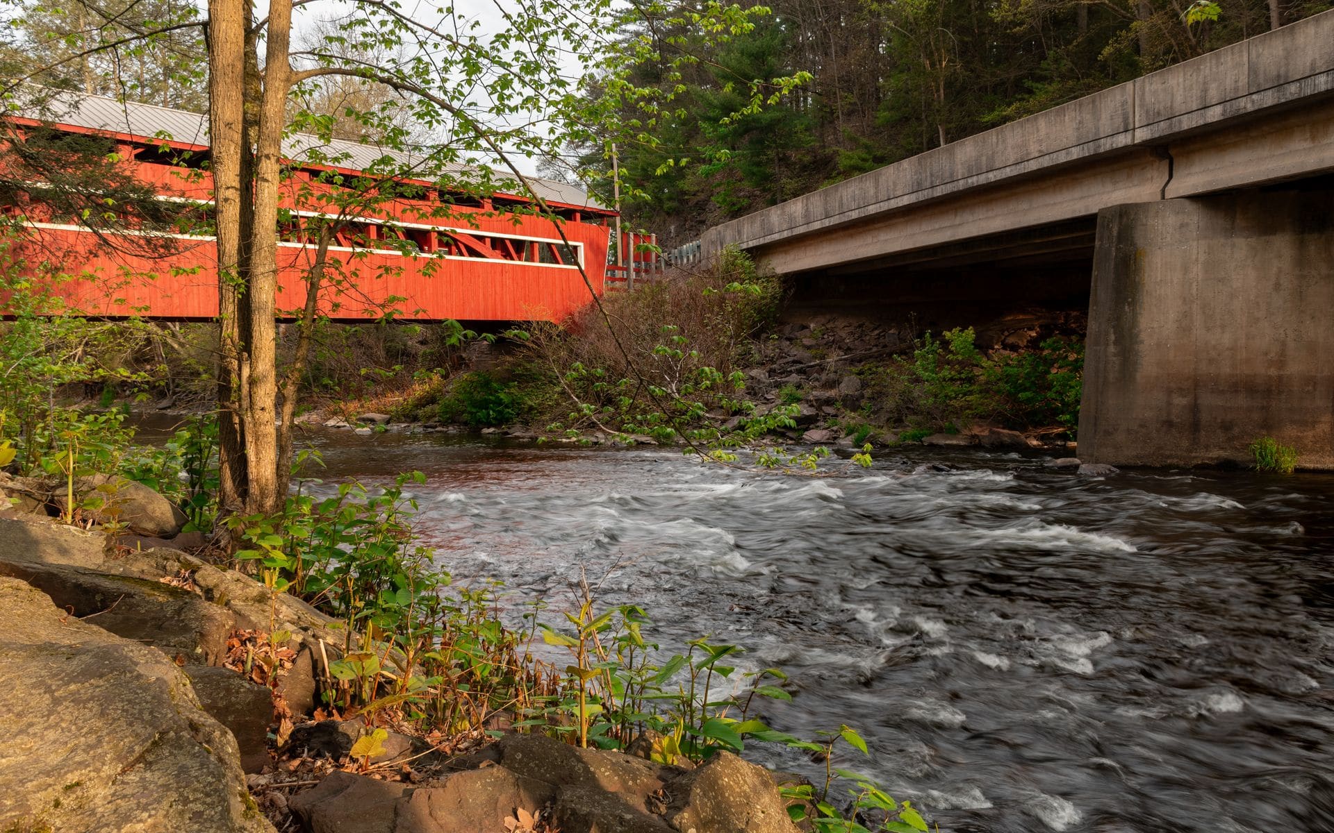
Windsor County around Woodstock has some of Vermont’s most visited covered bridges, most of them within 15 miles of the village center. The Taftsville Covered Bridge sits on Route 4 about 3.5 miles east of downtown Woodstock, spanning the Ottauquechee River. Built in 1836 using a multiple kingpost truss and a Burr arch, it’s one of the oldest covered bridges still carrying vehicle traffic in the state. The setting is simple: a red bridge over a clear river, backed by a wooded hillside. In late October, when the foliage is past peak at higher elevations but still running in the valley, the color around Taftsville can be the sharpest in the region.
In downtown Woodstock itself, the Middle Bridge crosses the Ottauquechee near the village green, a short walk from the Woodstock Inn and the Billings Farm and Museum. The Lincoln Bridge sits about 5 miles west of town in West Woodstock, also spanning the Ottauquechee. Woodstock is a natural base for this cluster: you can walk or drive to three bridges within an hour without leaving the township. If you’re figuring out how to allocate days for this area versus other parts of the state, how many days do you need in Vermont has practical pacing advice.
The Cornish-Windsor Covered Bridge, 13 miles south of Woodstock on Route 5 in Windsor, is the one that stops most people who think they’ve seen enough covered bridges. At 460 feet across two spans, it’s the longest two-span wooden covered bridge in the United States. It connects Windsor, Vermont to Cornish, New Hampshire over the Connecticut River. Built in 1866, it still carries car traffic on a single lane with a posted weight limit and a posted 10-mph speed limit. There’s a small parking area on the Vermont side where you can pull off and walk it. Our full Best Covered Bridges in Vermont list includes the Cornish-Windsor Bridge alongside a handful of other standouts across the state worth seeking out.
Southern Vermont: The Scott Bridge in Townshend
Townshend sits in Windham County about 45 minutes north of Brattleboro on Route 30. The Scott Covered Bridge here, at 277 feet, is the longest single-span covered bridge in Vermont. It crosses the West River near Scott Farm and is no longer open to vehicle traffic, making it pedestrian-only. That’s an advantage: you can stand in the middle over the river without cars coming through, and the West River runs clear and shallow underneath in summer.
The town of Grafton, about 12 miles east on Route 35, has the Grafton Village Covered Bridge and an intact 19th-century village that gives the two stops a good half-day pairing. Townshend State Park is nearby if you want to add a short hike to Bald Mountain above the village. The Windham County area is the last part of Vermont where foliage peaks in fall, typically during the second or third week of October, so a late-season trip through Townshend and Grafton can catch color that’s already gone in the northern parts of the state.
North-Central Vermont: Emily’s Bridge and the Fisher Railroad Bridge
The Gold Brook Bridge near Stowe sits on Gold Brook Road off Route 100 in Morristown, about 3 miles south of the Stowe village. Locals call it Emily’s Bridge, tied to a 19th-century legend about a young woman who died there. The story has been embellished many times over, but it’s been around long enough that people still leave notes and small offerings on the railings. The bridge itself is practical history: a Town lattice truss built in 1844 spanning Gold Brook in a forested hollow. It’s an easy stop if you’re already heading to or from Stowe Mountain Resort, and it takes less than 15 minutes to walk out and back.
About 20 miles southeast of Stowe in Wolcott, the Fisher Covered Railroad Bridge crosses the Lamoille River on Route 15. It was built in 1908 to protect iron railroad structures from weather decay, the same logic applied to wagon bridges but scaled up for rail equipment. Very few covered railroad bridges survive anywhere in the country. The Fisher Bridge is no longer in active rail use but it’s well preserved and accessible from the road. The Lamoille Valley Rail Trail, a 93-mile multi-use trail that runs through Wolcott, passes near here and makes it worth combining with a bike ride if you have time.
For timing the northern bridges alongside foliage, late September through mid-October is the peak window in this part of the state, but the high elevations around Stowe and Jay Peak can be past peak by early October while valley bridges hold color a bit longer. When is peak fall foliage in Vermont breaks down the week-by-week progression by elevation and county so you can plan which bridges to prioritize first.
Planning Your Vermont Covered Bridge Route
Most people work covered bridges into a broader Vermont trip rather than making them the sole reason for coming. A practical base strategy: if you’re staying in Burlington, the Montgomery six-bridge loop is about an hour’s drive north and works as a half-day trip. The Pulp Mill Bridge in Middlebury, built around 1808 and one of the oldest in the state, is about 45 minutes south of Burlington on Route 7 and easy to combine with a stop at Middlebury’s downtown or the Otter Creek brewery. If you’re based in the Upper Valley, Taftsville and Middle Bridge are within walking and biking distance of Woodstock, and the Cornish-Windsor Bridge is a 20-minute drive south.
Back roads near covered bridges are often unpaved or narrow two-lane state highways where 20 to 25 mph is the practical speed. Give yourself extra time. Vermont’s two-lane roads in the valleys can back up behind slow farm traffic or leaf-peepers in October, and GPS directions sometimes route you onto roads that are rougher than they look on a map. A printed or downloaded Vermont covered bridge map with road numbers is more reliable than satellite navigation for finding the small ones. Check the best time to visit Vermont to line up your bridge route with the season that works for your trip, whether that’s the foliage peak in September and October, the green quiet of May and June, or the snow-covered look of February.
Frequently asked questions
How many covered bridges are in Vermont?
Vermont has approximately 100 covered bridges still standing, giving it the highest density of covered bridges per square mile of any state in the country. The number changes slightly over time as bridges are restored or occasionally lost to floods. Windsor County around Woodstock and Franklin County around Montgomery have the highest concentrations, but they’re spread across most of the state’s counties.
What is the longest covered bridge in Vermont?
The Cornish-Windsor Covered Bridge connecting Windsor, Vermont to Cornish, New Hampshire is the longest at 460 feet across two spans. It’s also the longest two-span covered wooden bridge in the United States. For the longest single-span bridge entirely within Vermont, the Scott Covered Bridge in Townshend holds that record at 277 feet over the West River.
Are Vermont’s covered bridges free to visit?
Yes, virtually all of Vermont’s covered bridges are free to visit. They sit on public roads or have free pull-off access. The only cost is getting there. Most bridges require navigating town road numbers that don’t appear on highway signage, so download the Vermont Division for Historic Preservation covered bridge map or their online listing before you leave. GPS helps, but a physical map with road numbers is more reliable for the smaller rural ones.
When is the best time to photograph Vermont covered bridges?
Late September through mid-October gives you the fall foliage backdrop that most visitors come for. Morning light is best at most bridges since many face east and surrounding hills block afternoon sun. May and early June offer clean green fields and empty roads without the crowds. Winter gives a different look, with snow on the roofs and bare branches overhead, though some back roads leading to bridges can be icy or rough in January and February.
Can you drive through Vermont’s covered bridges?
Many of Vermont’s covered bridges still carry vehicle traffic, typically on a single lane with posted weight limits and low-speed requirements. A few, including the Scott Covered Bridge in Townshend, are closed to cars and pedestrian-only. Single-lane bridges operate on a yield system: pull in when it’s clear and yield to oncoming traffic waiting on the other end. If you’re traveling in a large truck or RV, check the posted weight limits before crossing.